Water Utilities
Are you still relying on paper maps or an outdated GIS system to manage your waterworks? It’s time to embrace innovation! Join us for an exclusive presentation on our hosted GIS solution designed specifically for waterworks management—no advanced GIS skills required! Discover how our intuitive platform will streamline your operations, enhance data accuracy, and empower your team to make informed decisions with ease. Don’t miss this opportunity to elevate your waterworks management to the next level!
Services We Provide:
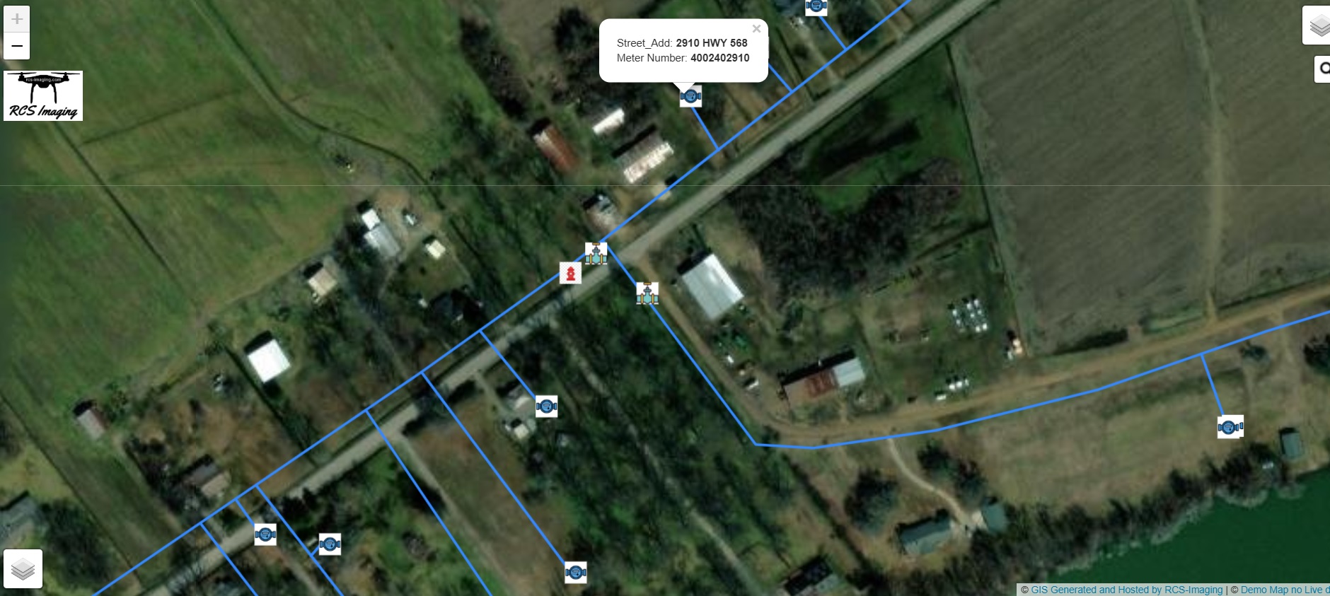
- GIS Interactive live Data Maps – Check Demo Map here
- Data import of smart metering, Valves, Fire Hydrants, and other important features.
- Displaying water lines for locations marked as 811 Call Before You Dig.
- Generating fire hydrant locations and providing real-time data for fire trucks.
- Displaying Drainage and Wastewater lines.
- High-resolution imagery depicting Water Meters, Tank location, and valve locations
- Georeferencing and aligning the plane of the the high quality images.
- Identify leaks or future hazards to cause leaks.
- Identify erosion areas
- Provides shape file of data and imagery to customer or any other format requested.
- Help the customer optimize the use of data in their current or developing GIS system.
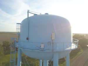
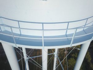
- Tank Inspections, Paint Inspections, and hot spots on the water tank.
- Existing equipment on the water tank.
Request a Quote for Hosted GIS Implementation Waterworks Company
Check out our Live Interactive GIS Demo today.

Paint inspection and equipment survery on water tower examples below along with hosted GIS screenshot: